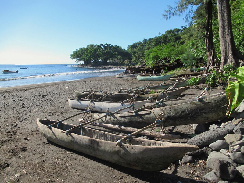
It is difficult to imagine navigating the ocean or even intracoastal without the benefits of technology…apps, global-positioning satellites, radio and other high-tech communication, web-enabled services for weather, currents, Gulf stream, and more. It is inconceivable successful sea navigation occurred prior to even understanding much of the science that was behind the natural “tools” they used. It is a topic of great interest to us so we thought we would share what we have learned about the amazing sailors before us.
Earliest Sailors
Since the oceans formed on our big blue marble we live on, people have heard and answered their enticing call to explore. Around 1500 B.C., the industrious Phoenicians from modern-day areas of Syria, Lebanon, and Israel desired to build a trading economy and were eager to acquire commodities as Spain’s silver, north Africa’s gold, and Sicilian tin. This required sailing the Mediterranean eventually breaching the safe limits of the Pillars of Hercules flanking the straits of Gibraltar venturing into the Atlantic.
About the same time in history, the Polynesians, Chinese, and East Asian sailors began exploring from their home ports eventually leading the way for vast exploration and exploitation of the Pacific and Atlantic Oceans. These courageous or perhaps fool-hardy ancient seafarers relied on ancestral lore and studious observations of the sky, ocean waters, wind, as well as flora and fauna in and out of the sea.
Landmarks: The Earliest Navigation Method
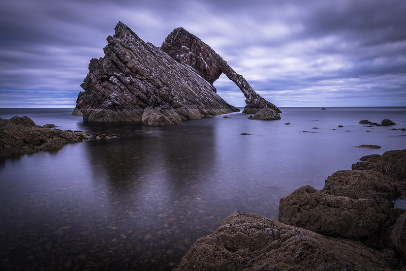
Early seafarers began much like beginner sailors do today. They plied their local waters during the day staying within sight of land making fastidious notes (or stories or songs…more on that in a bit) about recognizable landmarks such as hills, unique rock formations, clusters of trees or brush, and even man-made structures though they were certainly smaller and less permanent than today’s structures. By positioning their boat between landmarks, they had experienced or be told of, they could sail efficiently and safely from one place to another finding good anchorages for the night.
A sailor’s body of knowledge was expanded by expert navigators that held high esteem in various ports. The oral traditions in some cultures like the Polynesians was passed down through song. That’s pretty smart because a song is so much easier to remember! These traditional navigation methods are still taught in Taumako, a far western island of Polynesia.
To prevent catastrophic wrecks, the oral navigational stories and songs about landmarks included information about depths and sea floor and shore conditions such as sand, coral, rock, or mud. The mariners also dropped a weighted, marked line, called a leadline, overboard to collect depth information and bottom samples. The leadline is one of the first, if not the first human-made navigational tools.
The Sky: Essential Navigation for Venture Afar
While travelling locally by landmarks expanded horizons and enabled them to trade, overcome famines, evacuate people when necessary, and more, ancient sailors were as ambitious as most are today. They set their sights far beyond the confines of landmark navigation.
The sky became their navigational companion. During daylight, the sun movement pointed out north, south, east, and west. They sun’s angle on the horizon helped them assess distances when travelling toward or away from the equator.
When the sun gave way to nightfall, mariners relied to the stars and moon.
Northern Hemisphere
Polaris, known as the North Star, reliably pointed out north from south. Polaris, located in the famous Big Dipper, appears fixed in the sky and all other stars rise in the east and set in the west nightly giving the appearance of rotating around it. So, the farther north they sailed, the higher Polaris sat above the horizon and sailing south lowered it on the horizon.
Southern Hemisphere
Seafarers below the equator use a group of five stars called the Southern Cross (official name is Crux) is part of a cross-shaped constellation that helped navigators find due south. When they sailed north, the Southern Cross traveled across the sky in a lower arc each night, and vice versa when sailing south. There are various ways to work out direction using the Southern Cross. The video offers the most common.
The Southern Cross is important to nations below the equator and their people as is evidenced by its appearance on the flags of Australia, Brazil, New Zealand, Papua New Guinea, and Samoa. It is also mentioned in the national anthems of Australia and Brazil.
Interesting tip: The Southern Cross can be seen in the US if you are below 26 degrees north (Hawaii, Florida, and Texas) if you know where and when to look. It is the same for spotting Polaris in the Southern Hemisphere. Tips to find the Southern Cross in the Northern Hemisphere.
In those days, sailors were also quite proficient astronomers monitoring and documenting various constellations and stars to determine their boat’s changing position on earth. While the night sky was a valuable resource, it only helped with estimating north and south distances, and were of no assistance to determine movement east or west.
Clouds: More Clues from the Sky
If, like the ancient seafarers, you are a studious meteorologist on top of being adept astronomers, cloud shape, size, color, and location are helpful details.
Often, warm air rising from a landmass mixes with cooler air above giving way to fluffy white clouds that are quite different from high storm clouds. This helped sailors find land long before they could visually see it.
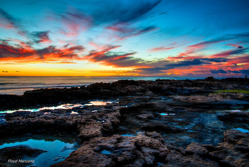
Clouds helped remove some of the uncertainty about using currents to navigate (more on that later) as they observed clouds to tell them about local or regional changes that were likely to occur to the currents as well as to know when they were in for stormy weather. They could determine when bad weather would hit and if they faced heavy rain or wind by noting cloud color and height.
Reflections: Romantic Land-Spotting
Moonlit reflections are incredibly romantic, but to ancient sailors, they were a highly useful sign of land. In fact sunlight and moonlight can reflect off sand or placid waters of lagoons creating a slight glow, or loom in the sky. This enable sailors to identify landmasses for either finding shelter or knowing where they were on the Earth’s surface.
Birds: Not-So-Flighty Navigational Aides
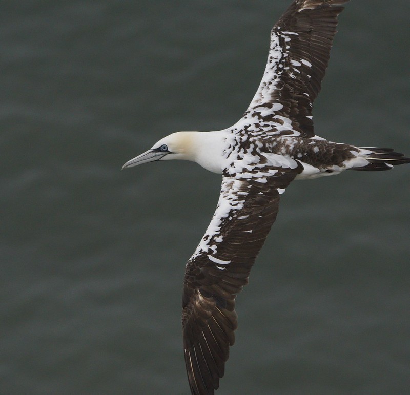
Early sailors in all parts of the world relied on bird appearance and behavior to help them establish direction and distances. These fowl helpers were surprisingly reliable.
Through observations and sharing knowledge, the sailors learned the seabirds’ habits. If they saw birds that stayed near land, they knew a landmass was near. And by taking note of those that traveled far out to sea to fish returning to land before nightfall they learned these long-range fishers gave the much-needed telltale signs of where land was.
Ancient mariners also observed migratory patterns that helped them sail further with confidence. Some historians believe that about 400 A.D., the Polynesians embarked on their maiden voyage from Tahiti to Hawaii by following the Pacific golden plovers’ migration.
And if using natural bird behavior was not enough, early mariners tended cages of shore-sighting birds aboard so they could release them for help in finding land. Polynesians may have brought frigate birds along on their journeys because these unusual seabirds’ feathers can become water-logged so they cannot float for very long. So the Polynesians knew the frigate birds would stay close to their dugout canoes unless they saw land.
Using avian creatures was particularly helpful to those sailing waters that did not provide enough help using the stars such as the Scandinavian sailors in night-less summers. These resourceful seafarers used ravens to discover Greenland and Iceland. If the released bird circled and returned, they knew they had to keep searching, but if it flew in a straight line, they followed it to their new destination.
Waves: Somewhat Tricky Navigational Tools
Globetrotters adept at exploring across oceans observed wave patterns to help them navigate, especially when other navigational tips like nighttime sky were not available. Swells and wave patterns appear differently near land than in the open ocean. The leeward (side away from the wind) waters of islands and big land masses because they block swells. Also, as deep-water swell surges flow into the shallows as they approach land, they become steeper and often break tipping sailors off to not only land, but also hidden dangers such as sandbars or reefs.
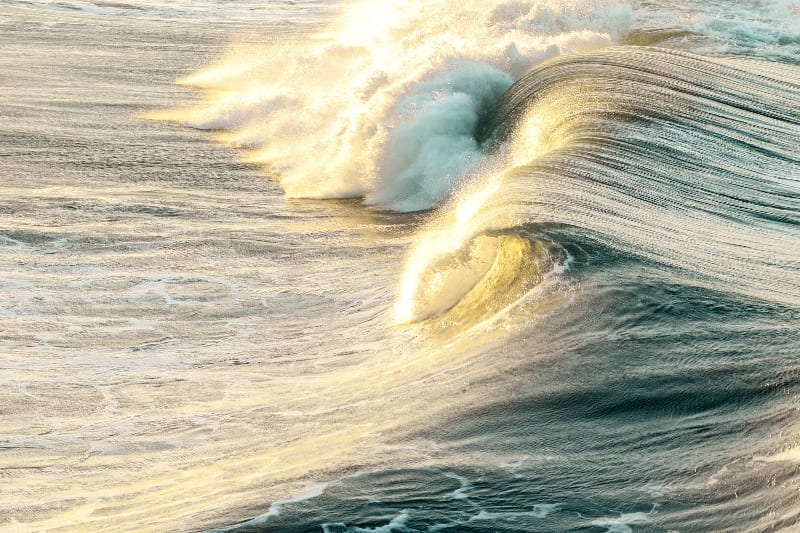
The wave patterns not only helped sailors find land, but also helped them predict the weather. Friendly trade winds blow consistently from one direction which produces consistent swells.
So the sailors could know their direction by following the swells, but they had to adjust how they followed by season as seasonal storms created predictable, but different wave patterns.
Early Oceanic sailors would not only observe the sea’s surface, they would also lie in the bottoms of their dugout canoes to detect small changes in the way the canoe responded to its contact with the water to detect unintended course changes.
While many sailed by waves, it was a much more complex system that was less reliable when regional storms erased the value of the wave patterns for days. Plus, understanding the system of waves and their seasonal changes took years of tutoring from veteran sailors along with a lot of practice.
Ocean Currents: Additional Guiding Signs
Just as the trade winds are fairly consistent, the oceans have consistent currents that behave like underwater rivers. Using their knowledge of the location and flow direction of these currents, they could better understand how far east or west they were. They identified currents by determining how cold or warm the water was as the climes of some currents are warm and others cold. Also, some currents appear a different color because of phytoplankton or they had floating sea weed laced edges.
By knowing the “map” of where major ocean currents were and observing water temperatures and water color to know when currents were encountered, sailors could determine how far west or east they were.
Seamarks: More Details, More Accurate Navigation
Early explorers noted occurrences in the ocean that appeared in the same place each time they were passed. These seamarks, like a landmark, predictably told sailors where they were.
A kelp forest, school of jellyfish, airborne flying fish, whale pods, or other natural phenomenon regularly anchored in one spot would be duly noted on the sailors’ mental map of the oceans.
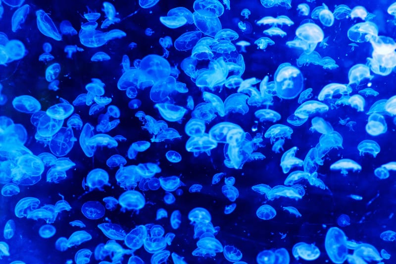
Seamarks can be affected by currents so, like other ancient navigational aids, much in-depth knowledge was required to read these map markers correctly.
The Compass: First Human-Made Tool for Navigation
Early explorers were probably some of the most knowledgeable people on Earth as they had to know tons of information about the sky, currents, waves, animals, and plants. They had to have been very courageous to sail into the unknown with these minimal tools. It is no wonder that innovation was sought to make navigation more reliable and safer. The Chinese used an early compass beginning in the second century B.C., but only for exploring land. The Europeans in the 12th century A.D., were the first to use a primitive version of a compass for traversing the oceans.
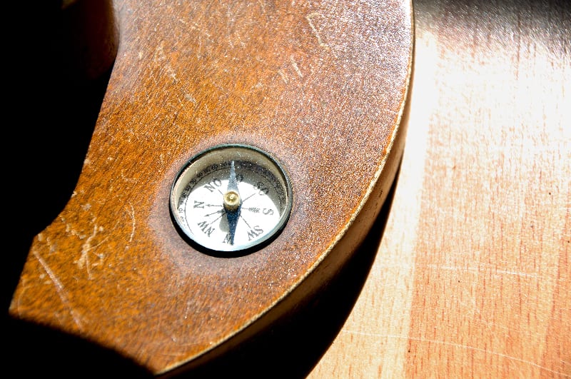
But, in its early years of use, it was not the wonder tool you would think it would be. In fact, they only used it as a last resort when the sun and stars were not available during inclement or overcast days. This is because the compass’ magnetic floating needle reacts to the Earth’s magnetic fields pointing to magnetic north, rather than true north. But the Polaris, the North Star, is always fixed pointing sailors to true north.
This discrepancy made its early users distrust the new tool so it was only a backup plan. Plus, sailors were (and are?) typically superstitious feared it thinking that the compass was driven by black magic and brought bad luck. Poor captains often had to keep their compasses stowed away from crews’ eyes to prevent it from being thrown overboard.
But by the 1300s, compasses were regular equipment and other navigational tools brought innovations that made it easier to make more accurate navigational calculations. Examples of more modern, but early, sailing innovations include the distance and altitude measuring sextant, latitude-calculating astrolabe, and speed-measuring chip log (where “knot” comes from) made it easier to calculate distances and direction.
When you realize that some of the most famous explorers like Columbus and de Gama got lost on the biggest expeditions of their life with all the new technology of the 15th century, it is humbling to realize just how clever and courageous the ancient seafarers were.
There’s an App for That: Today’s Navigation
We have a cushy sailing life today with our state-of-the-art navigational tools such as the gyro compass, automatic radar plotting (ARPA), GPS and trackers, electronic chart display information system (ECDIS), automatic identification system (AIS), autopilots, depth sounders, satellite communication, and modern seamarks such as buoys, lighthouses, and ever-present ambient glow of most land from electric lights. It is interesting to think that in a couple of centuries how “quaint” future sailors will think our technology is.
But, luckily there are many electronics, apps, and other tools to create safe, more relaxing voyages. But even today’s sailors must possess a lot of knowledge about the sea, sky, and basic procedures that keep them and their vessel safe and on the right course.
We suggest these articles to boost your navigation skills:


